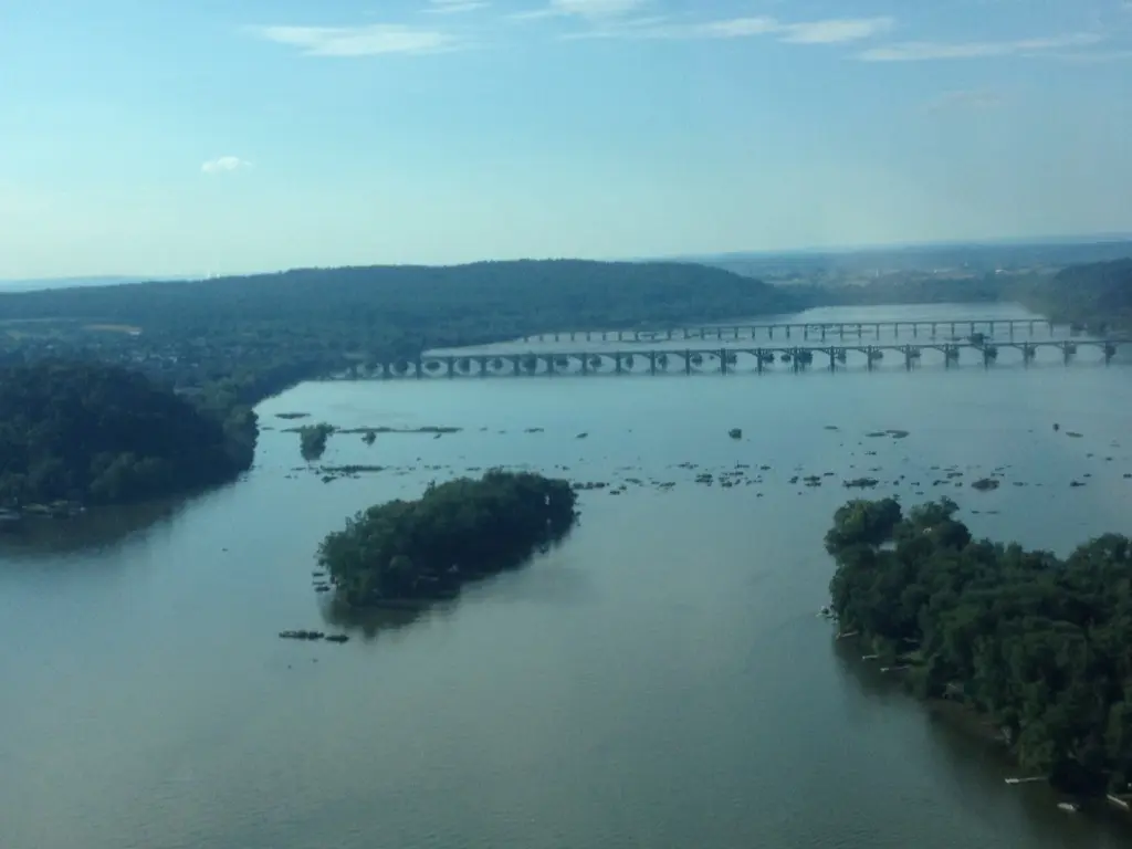
The Mighty Susquehanna River(keeper)

© pam lazos – aerial view of the Susquehanna at the Wrightsville and Columbia Bridges
I recently joined the Board of the Lower Susquehanna Riverkeeper Association (LSRA), a small but mighty organization headed by Riverkeeper, Ted Evgeniadis, who utilizes Education, chemical and biological monitoring, pollution patrols, partnership building, public events, research and legal action to improve the health of the Susquehanna’s waterways.
The Lower Susquehanna River covers roughly 8,527 square miles from Selinsgrove, PA, to the Chesapeake Bay at Havre De Grace, MD. Some facts about the Susquehanna for those who don’t know or for those who live in the area but want a deeper dive (although, note to self, much of the Susquehanna isn’t deep enough to do that).
- The Susquehanna River is North America’s longest, commercially non-navigable river and geologically one of the world’s seven oldest rivers, dating back to the Paleozoic Era (543 to 248 million years ago) — and older than that youngster, the Nile, which is only 30 million years old.
- It’s the largest river draining into the Atlantic Ocean, located entirely within the United States’ borders.
- The Algonquian Indians named the Susquehanna Muddy River. It’s still muddy, but today, we call it the Mighty Susquehanna River for its sheer length and breadth.

- Historically, the Susquehanna River provided a bounty of resources to those dwelling along its banks, including the Susquehannock and Lenape Native Americans, who relied upon the river for food, trade, and transportation.
- The Susquehanna near Safe Harbor Dam is home to Native American petroglyphs, which were thought to be the work of the Shenks Ferry people, who carved them over 1,000 years ago.
- Today, the Susquehanna River is a critical source of drinking water for millions living along its banks, providing freshwater to various communities, including New York, Pennsylvania, and Maryland residents. LSRA continually monitors water quality in the Lower Susquehanna River through its sampling and analysis programs, keeping track of water quality and drinkability.

- For most of the Susquehanna’s 444 miles, the river meanders like a lazy teenager, falling a couple of feet or so per mile. Once it reaches Lancaster County, the drops become more dramatic until the final 27 miles, when the Susquehanna falls 208 ft. or 7.7 ft. per mile. This steep drop has resulted in the creation of four major hydroelectric dams on the Lower Susquehanna and some amazing vistas.

This Friday, August 30th, 2024, LSRA is having an open house at its new location at 338 S. Front St, Wrightsville, PA. Stop by and learn about all the incredible work being done by the Riverkeeper to keep our water drinkable, swimmable, and fishable.
Prepare to be amazed.

RSVP here — or just come, have a nosh and a beer and learn about the amazing Susquehanna River. Thanks for reading.
pam lazos – 8.28.24
Originally Published on https://greenlifebluewater.earth/feed/


